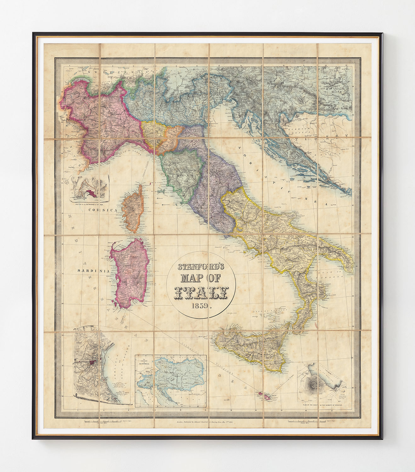
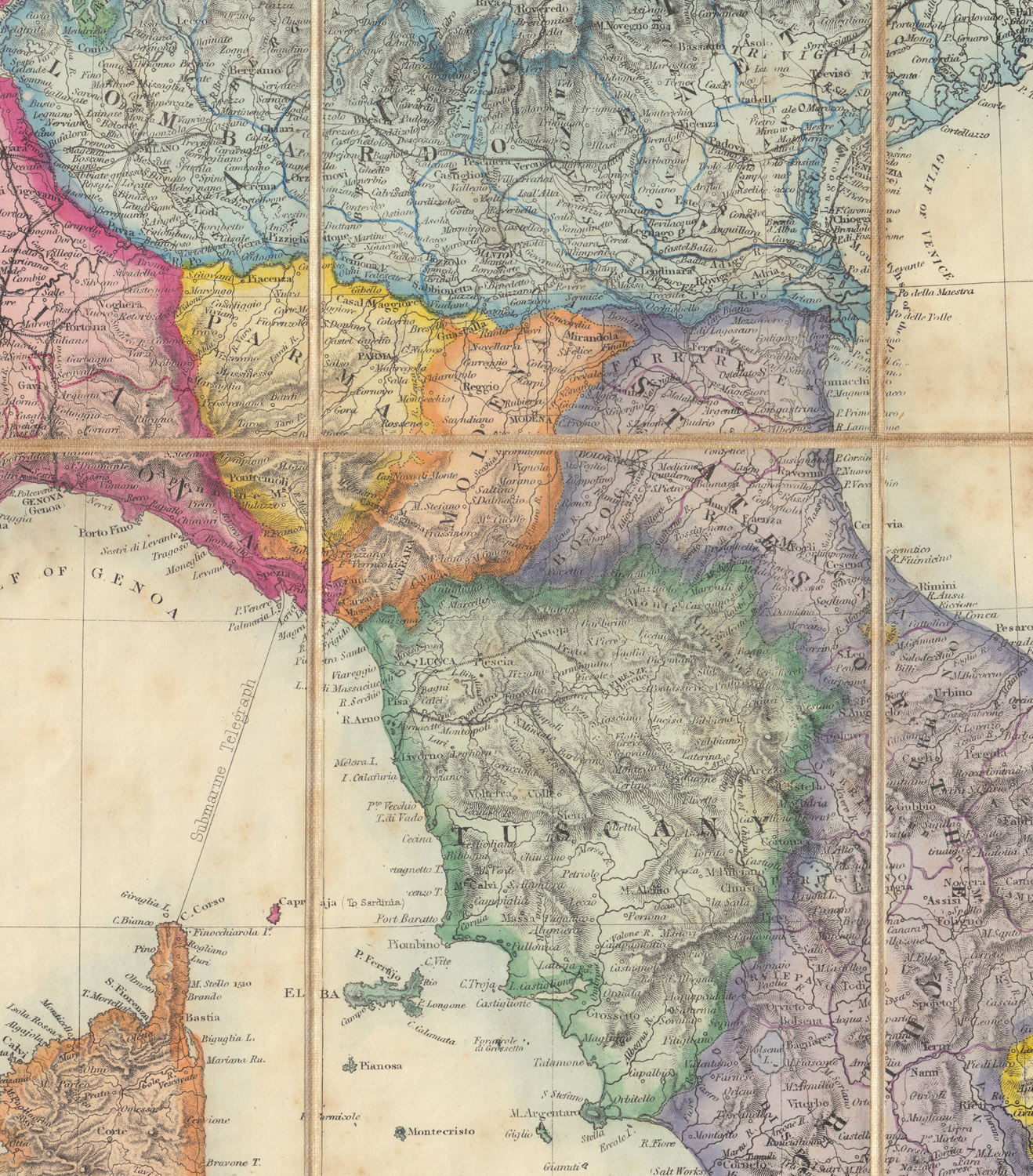
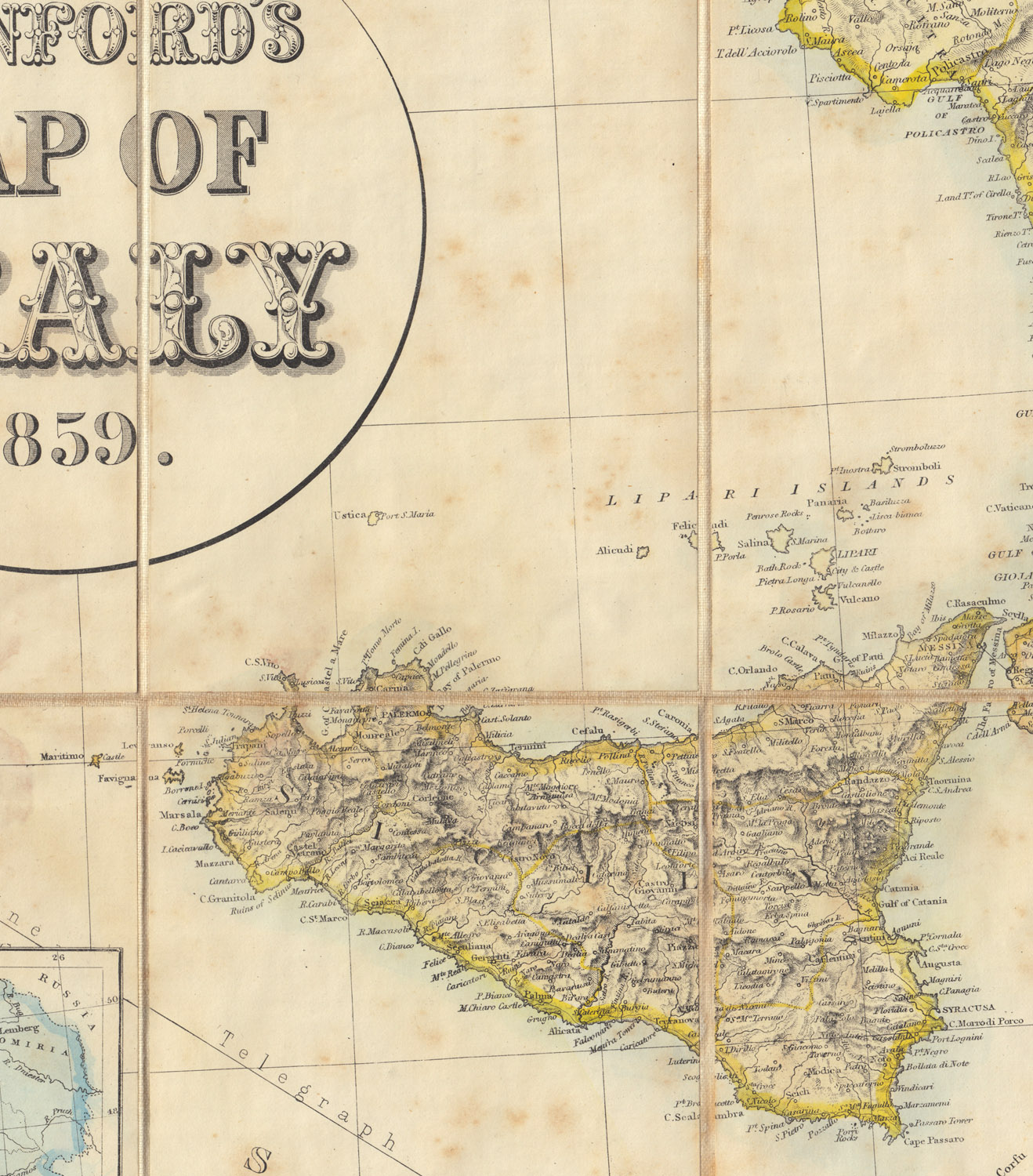
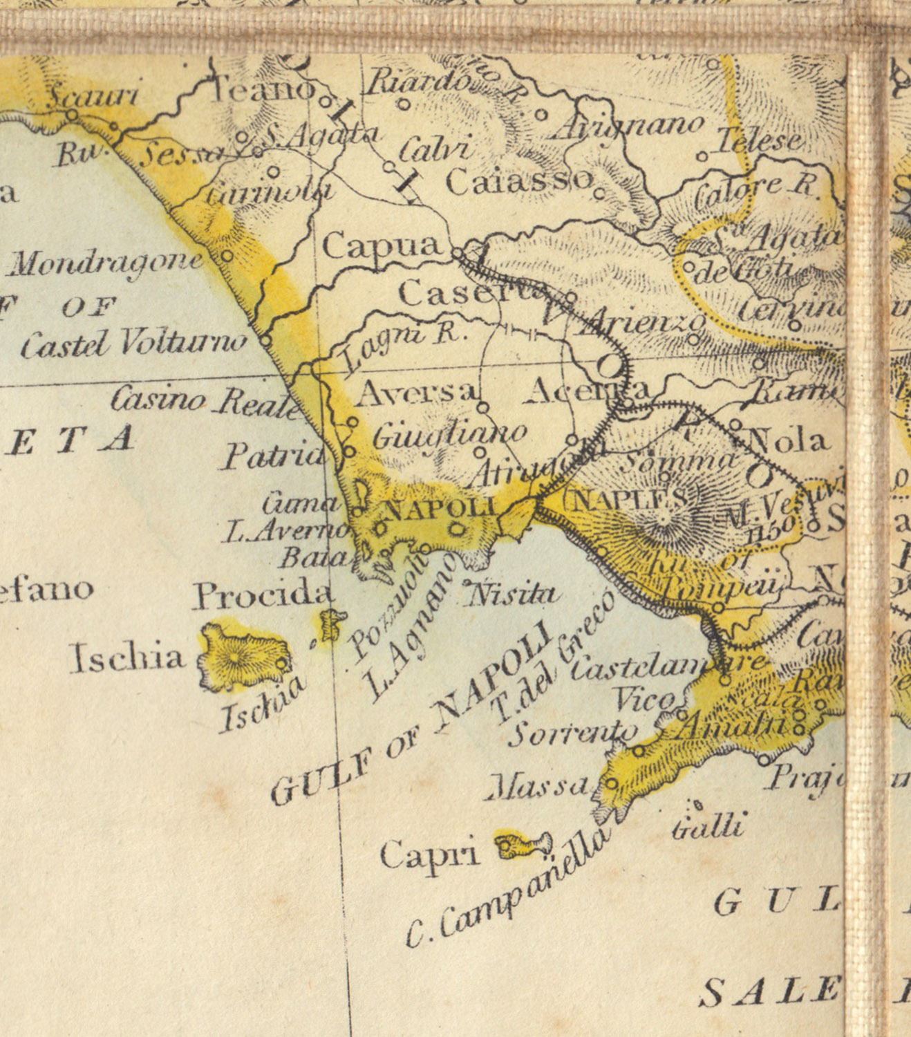
Stanford’s 1859 Map of Italy
Price range: $262.98 through $527.98
Stanford’s Map of Italy, 1859 Created by noted English cartographer Edward Stanford during a time when the separate states of Italy were struggling toward unification. The colors on this map are exceptional.
Art Print:
Printed on acid-free, fine art paper. Fine art papers offer the greatest archival stability with image permanence often approaching – or even exceeding – 100 years. (10 mil thickness)
Shipping:
$75 Anywhere in North America, other destinations require a quote. Email us
Stanford’s 1859 Map of Italy
Stanford’s Map of Italy, 1859 Created by noted English cartographer Edward Stanford during a time when the separate states of Italy were struggling toward unification. The colors on this map are exceptional.