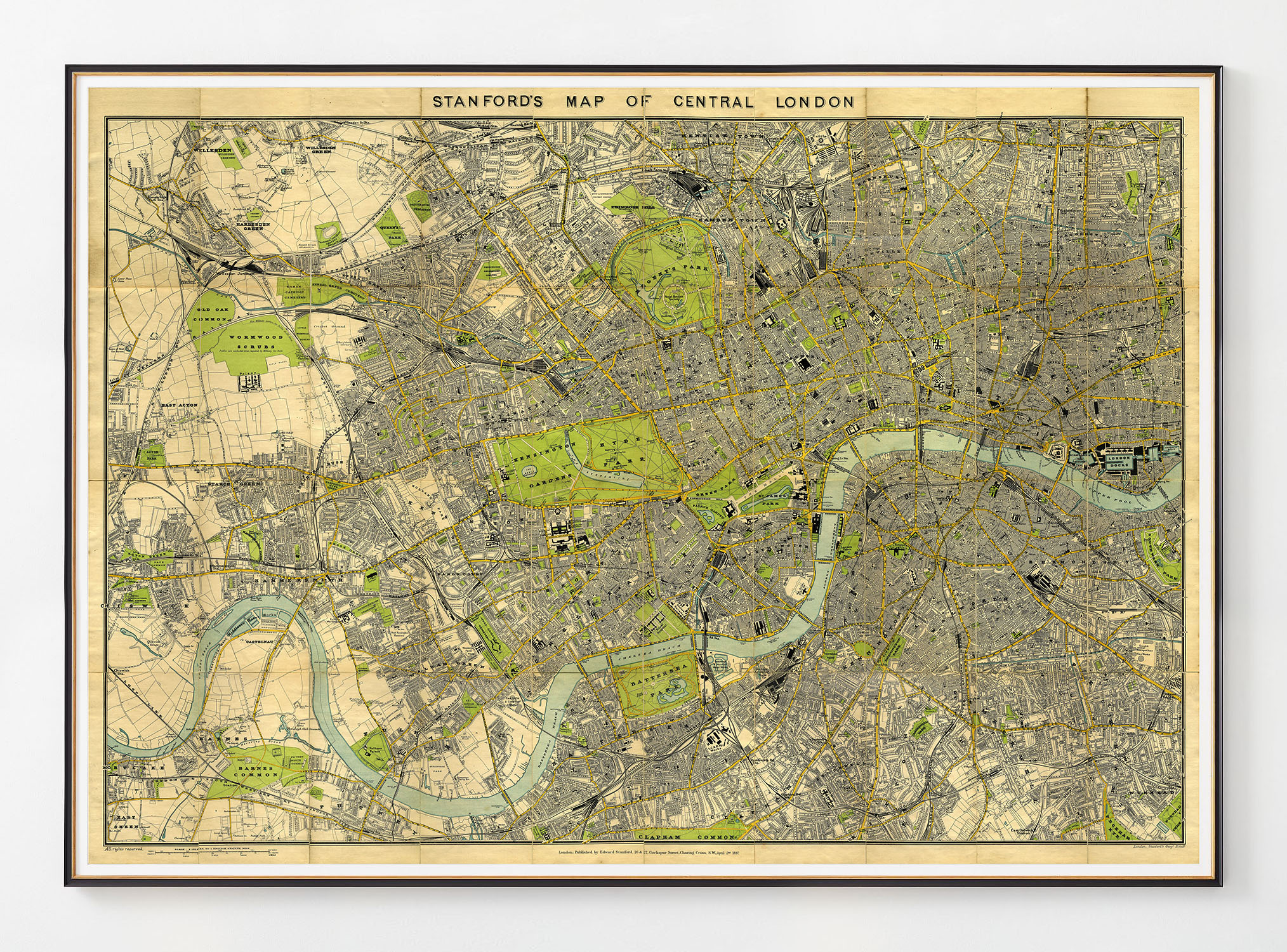
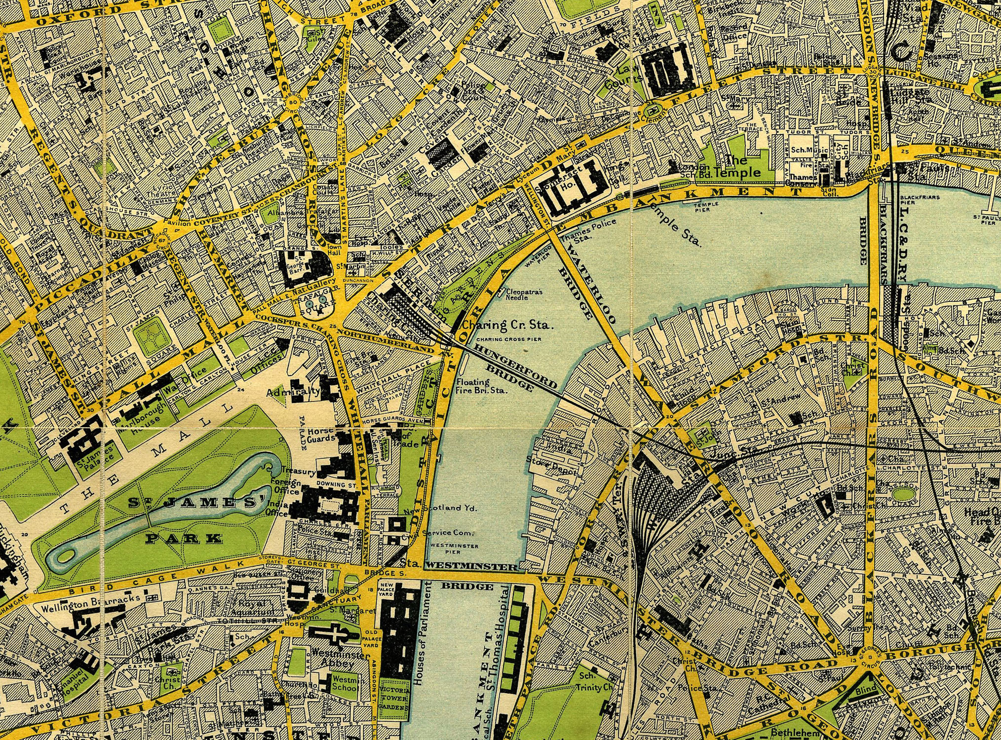
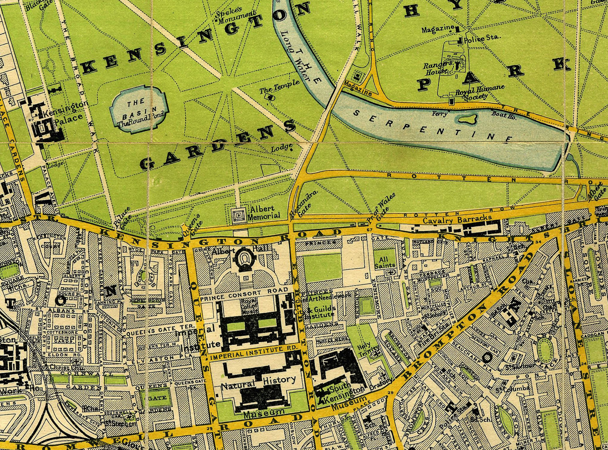
Stanford’s Map of Central London 1897
Price range: $319.98 through $640.98
Stanford’s Map Of Central London – Edward Stanford, 26 & 27, Cockspur Street, Charing Cross, S.W.
Art Print:
Printed on acid-free, fine art paper. Fine art papers offer the greatest archival stability with image permanence often approaching – or even exceeding – 100 years. (10 mil thickness)
Shipping:
$75 Anywhere in North America, other destinations require a quote. Email us
Stanford’s Map of Central London 1897
Stanford’s Map of Central London, showing the districts of The City of London as well as Westminster. Published by Edward Stanford, 26 & 27 Cockspur Street, Charing Cross. 1897.